June, 2026
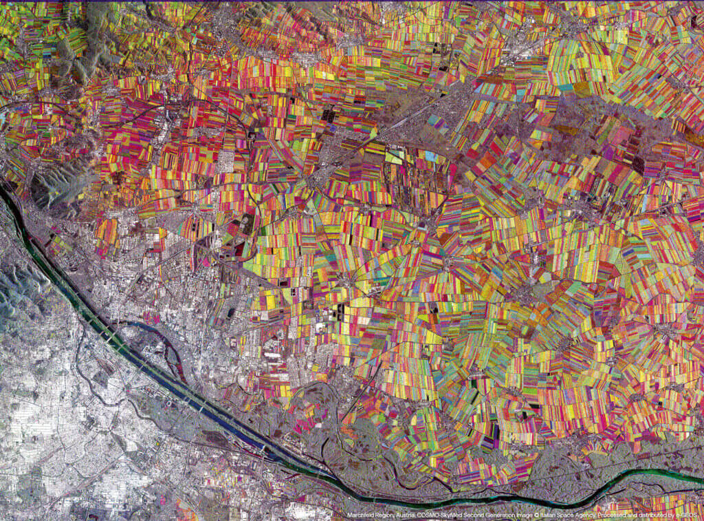
Marchfeld Region, Austria
Geoinformation can provide key insights for making sustainable water resource management more efficient, monitoring availability and quality, identifying leaks, and optimising the operation of irrigation systems. In the Marchfeld region of Austria, satellite data is used to reduce waste, improve irrigation planning and support strategic decisions on water management. The analysis of satellite data enables the production of soil moisture maps, multispectral analyses and water infrastructure monitoring based on Earth Observation data, offering the opportunity to combine productivity, environmental protection, responsible use of natural resources and the socio-economic development.