October, 2026
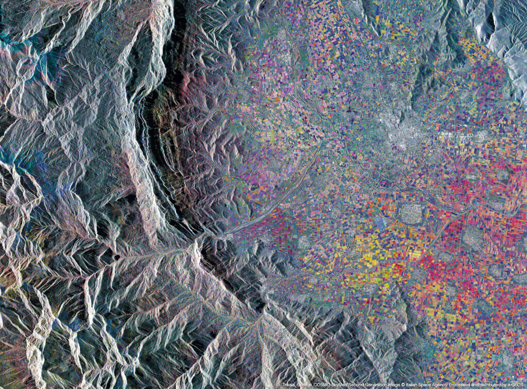
Trikala, Greece
From Space it is possible to analyse the health of the soil in detail, evaluating its physical and chemical parameters and identifying areas at risk of degradation. Satellite data allows the evaluation of information relating to erosion, salinisation and loss of fertility, providing useful insights for the conservation of resources. In Trikala – the agricultural heartland of Greece, which is however vulnerable to desertification due to semi-arid climatic conditions and intensive management – these technologies provide crucial support for monitoring changes over time and implementing effective adaptation strategies. They offer local stakeholders the opportunity to protect the land, reduce the impact of agricultural practices and ensure the long-term sustainability of the territories.